Skip to content
Studies & insights
All studies
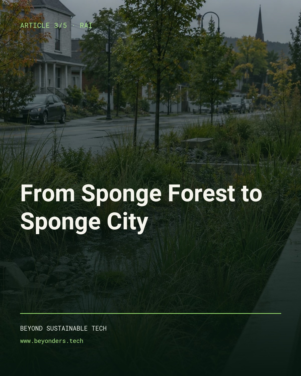
Cover of the third RAI article: from sponge forest to sponge city

Article 3/5 · RAI · FOREST · CITY · WATER

From Sponge Forest to Sponge City

Why protecting a city from flooding requires retaining, slowing and cleaning water from the headwaters of the watershed to every street.

Alain Bélanger, forestry engineer

One article. Three ways to explore it.

Article and presentation in English. Podcast in preparation.

Podcast coming soon

The audio conversation for this third article is in preparation.

The full article · RAI 3/5

A City Receives More Than the Rain That Falls on It

When a city floods, we naturally look at the rain that fell on its streets. We examine the catch basins, storm sewers, retention ponds, pumping stations, and the capacity of the drainage network. Those elements are essential. But they do not tell the whole story.

Part of the water that floods a city may have fallen several hours — and sometimes several days — earlier on forests, fields, wetlands, roads, and tracks much higher up in the watershed. That water begins its journey far from the city. It enters a ditch. The ditch drains into a small spring or swale. That feeds a brook. The brook joins a larger stream. Tributaries meet one another. And all of it gradually descends toward the lower points of the territory, where many communities historically developed near large rivers, lakes, and estuaries.

A watershed ignores municipal boundaries. It ignores the limits between public forest and private land. It ignores the border between one neighbourhood and the next. Ultimately, all of that water belongs to the same system. That is why protecting a city from flooding cannot begin only at the first street within the municipality. It must begin at the headwaters of the watershed.

What the First Two Articles Established

In the first article of this series, I explained how thousands of kilometres of roads, ditches, culverts, and compacted surfaces can ultimately form a second drainage network superimposed on the natural hydrographic network. At the scale of a single road, that logic is rational: we want to maintain bearing capacity, protect the structure, and avoid water and frost damage.

The problem appears when the effects of the entire network are added together. In two Oregon watersheds, up to 57% of the studied road length could function as a flow path. Some segments delivered water directly to streams; others created new erosion gullies. At Caspar Creek in California, modelling showed that an older road network located close to streams could increase peak flows by as much as 46%, whereas a newer network repositioned away from the hydrography raised peak flows by less than 2%.

The second article then examined the consequences of water that is not retained: declining soil moisture, hydraulic stress in vegetation, disruption of biological life, loss of resilience during drought, and greater vulnerability of the territory when the next spark occurs. The third article now needs to connect those two findings to the city. Because water that is moved too quickly upstream does not disappear. It moves. And someone, somewhere downstream, ends up receiving it.

The Travel Time of Water

Water that falls on a watershed does not reach the main river all at once. Its movement depends on many factors: the size of the basin, slope, soil properties, the level of initial saturation, vegetation cover, wetlands, lakes, drainage density, compacted surfaces, roads, ditches, culverts, and the distance between the rainfall area and the city.

Rain falling in the upper part of a watershed may therefore generate a flood wave that will reach the city only hours later. In a larger basin, the delay can be even longer. That time lag can create a false sense of security. Rain has already stopped upstream. The sky may even have cleared. But the water continues travelling through soils, ditches, springs, streams, and rivers. The flood wave is still on its way.

When Two Flood Peaks Meet

A city can face two distinct phenomena. The first is local pluvial flooding: rain falls directly on roofs, parking lots, roads, and sidewalks, and the volume or intensity exceeds the capacity of surfaces, catch basins, and sewers to absorb or convey it. The second is fluvial flooding: water arriving from upstream reaches the river, and discharge exceeds the capacity of the channel, banks, or flood-protection works.

The U.S. Environmental Protection Agency clearly distinguishes those two situations: localized flooding when rainfall exceeds the capacity of urban drainage systems, and river flooding when the flow exceeds the capacity of the watercourse. The risk becomes especially important when the two peaks occur close together in time.

Imagine the following scenario. A major rainfall occurs in the upper watershed. Roads and ditches accelerate part of the transfer toward streams. The flood wave begins to descend. A day later, another rainfall falls directly on the city. The city must then handle at the same time the water falling on its own streets, water from roofs and parking areas, water discharged by neighbouring districts, water drained by agricultural or forested land, and the flood wave already present in the river. The city is no longer receiving only a storm. It is receiving the sum of several systems, all designed to transfer water quickly downstream.

“Infrastructure can be locally efficient while collectively worsening risk at the lowest point of the basin.”

A Sponge City Begins Upstream

A sponge city is often presented as an urban-design concept: rain gardens, green roofs, floodable parks, permeable pavements, tree pits. Those solutions are important. But they are not enough if the upstream territory continues accelerating water toward the city.

A real sponge-city strategy must therefore begin well before the municipal boundary. It must protect or restore watershed functions: soils capable of infiltrating, forests, peatlands, wetlands, floodplains, lakes and ponds, riparian zones, meanders and overflow spaces, areas where flow can be slowed and spread, and roads whose ditches are disconnected from streams.

These environments are not unused land. They are hydrological infrastructure. They temporarily store water. They reduce some peak flows. They contribute to recharge. They help support flows during dry periods. And they protect the communities located downstream.

The EPA specifically recommends combining urban green infrastructure with protection of floodplains and absorbent spaces at the watershed scale. This approach can reduce both local flooding and the volume of water ultimately reaching rivers.

“A city cannot become a sponge if its watershed has lost the functions that once slowed water before it arrived.”

How a Forest Functions Like a Sponge

A forest does not absorb every drop of rain. It does not prevent all floods. It does not replace dams, retention basins, or protective works. But a functional forested territory multiplies the surfaces, pathways, and obstacles that water must cross.

The canopy intercepts part of the rainfall. Leaves and branches reduce the energy with which rain strikes the ground. The litter layer slows runoff. Roots create pathways. Organic matter supports porosity. Microorganisms help structure the soil. Natural depressions retain water temporarily. Wetlands absorb part of the excess. Vegetation uses water and gradually returns part of it to the atmosphere.

Water is slowed. Spread. Infiltrated. Stored. Used. Then released gradually. The sponge forest therefore does not rely on a single technology. It relies on a multitude of functions distributed throughout the territory.

Our Cities Often Do the Opposite

In a conventional city, rainfall encounters an almost opposite system. Roofs direct it to gutters. Asphalt driveways push it toward the street. Parking lots and sidewalks limit infiltration. Soils have often been excavated, backfilled, and compacted. Curbs concentrate the water. Catch basins capture it. Pipes transport it. Outfalls discharge it.

The city becomes a vast machine for moving water horizontally. Roads, roofs, parking lots, sidewalks, and compacted soils are among the main impervious surfaces in an urban watershed. By reducing infiltration and increasing direct hydraulic connectivity to sewers and watercourses, these surfaces generally produce peak flows that are more frequent, higher, and faster. They also favour erosion and the transfer of contaminants to receiving waters.

The city no longer receives rain as a living territory. It receives it as a pipe network.

Flooded Today, Dried Out Tomorrow

The same city can flood during a storm and run short of water a few days later. The paradox seems difficult to understand. Yet it is identical to what we observe in forested watersheds: too much water, too fast, during the event; then too little water retained when the heat returns.

Water that could have infiltrated is sent into a pipe. Water that could have supported a tree is sent to the river. Water that could have contributed to recharge leaves the neighbourhood. Then, after the rain: the pavement begins absorbing heat again; compacted soils dry out; urban trees enter stress; parks need irrigation; and the drinking-water system is put under pressure. The city received the water. But it did not keep it.

Water and Heat Are the Same Urban Problem

Flooding and urban heat islands are often managed by different departments: stormwater on one side, urban planning or public health on the other. Yet they partly arise from the same design choice. A highly mineralized city has fewer surfaces able to absorb water and less vegetation able to use that water to cool the environment.

Roads, parking lots, and buildings accumulate solar energy. When trees lack enough soil, space, and water, the city simultaneously loses shade, evapotranspiration, interception, biodiversity, and thermal comfort. Water retained in urban soil therefore does not only help prevent flooding. It supports vegetation. It contributes to cooling. It reduces tree stress. It extends tree life. And it can reduce part of the need for irrigation and air conditioning. A city that keeps its water better protects itself both from excess water and from its absence.

Each Neighbourhood Must Manage Its Share of Rainfall

Responsibility cannot rest only on the central municipal network. It must be distributed. A new subdivision should not be considered high-performing simply because it succeeds in sending all of its water outside its own boundary. In that case, it merely transfers its problem to the neighbouring lot, the lower district, or the collective network.

A resilient design should follow an order of priority: retain part of the water at the source; slow its movement; store it temporarily; reuse it where it can support vegetation; infiltrate it where water quality and soil conditions allow; filter it when it carries contaminants; and safely evacuate only the excess.

That logic should apply at every scale: the property, the parking lot, the commercial development, the street, the laneway, the neighbourhood, the industrial area, the municipality, and the full watershed. I call this principle distributed hydrological responsibility.

“Each property, each street, and each neighbourhood should keep part of the water it receives, instead of turning all of that water into a problem for the neighbour downstream.”

The Street Is the Missing Link

Many cities already invest in floodable parks, rain gardens, green roofs, basins, enlarged tree pits, and permeable pavements. Those projects are useful. But they often remain separate from the street network.

Yet the street connects almost every component of the city. It runs beside buildings. It receives water from roofs, driveways, and parking lots. It hosts water, power, and telecom utilities. It crosses neighbourhoods. It connects high points to low points. It is one of the largest continuous public surfaces in the city.

The street should therefore no longer be considered only as a traffic surface. It can become distributed climate infrastructure. A regenerative street could combine a structure able to distribute loads, reduced unnecessary compaction, lateral infiltration spaces, soil cells for trees, temporary storage zones, filtering media, safe overflows, sensors, and a maintenance-and-replacement program.

Retaining Water Is Not Enough

We must add a crucial dimension: water that is retained or infiltrated is not automatically clean water. Roads accumulate a wide range of contaminants: tire particles, microplastics, brake dust, metals, hydrocarbons, oils and vehicle fluids, suspended solids, de-icing salts, and organic compounds associated with vehicle and pavement wear.

The EPA notes that impervious surfaces increase not only the volume and speed of runoff, but also the delivery of sediments, metals from wear, organic pollutants, oils, and grease to streams. A regenerative street should therefore not simply create an opening into which all water can flow. It must decide which water can be infiltrated, which should be slowed, which must be filtered, which must be stored temporarily, which should go to complementary treatment, and which must be evacuated during extreme events. The objective is not to move pollution from the river to the groundwater table. The objective is to intercept that pollution as close as possible to its source.

6PPD and Tire Dust

One compound we need to monitor especially closely in road runoff is 6PPD. It is used in tires to protect them from ozone degradation. As tires wear, particles accumulate on road surfaces. In the environment, 6PPD can transform into 6PPD-quinone (6PPD-Q), a compound of particular concern for some salmonid species. Rainfall can then carry those particles and associated chemicals from roads into creeks and rivers.

Tire particles are also a form of microplastic pollution. They do not necessarily remain beside the road. They can be transported by runoff, ditches, storm sewers, rivers, wind, and sediments. The road network therefore becomes both a mobility system and a contaminant-transfer pathway.

Can We Decontaminate Water Before It Reaches the River?

Early studies indicate that source treatment is technically possible. A full-scale experiment on a mature bioretention cell in Vancouver observed about a 95% reduction in the mass of 6PPD-Q reaching the underdrain. The associated modelling indicated that, during most rainfall events considered typical, the system could reduce by more than 90% the load discharged directly to receiving waters. The authors note, however, that performance drops during larger storms when the system overflows.

Another study on permeable pavements measured more than 96% retention of tire-particle mass, an average 68% reduction in 6PPD-Q mass, and variable performance for other tire-associated compounds. Those findings do not mean that a single system can remove every pollutant under all conditions. They do demonstrate three important things: the street can become a treatment location; it is preferable to intercept contaminants before they disperse into a large watercourse; and system design — including area, volume, retention time, and media composition — strongly influences performance.

Recent simulations also suggest that adding specific media, including biochar, may improve the capture of more mobile compounds in bioretention systems. The researchers nevertheless emphasize that full-scale validation remains necessary. This is exactly the kind of validation we need. We should not claim that one particular medium will automatically remove 6PPD-Q, microplastics, hydrocarbons, or other contaminants. We need instrumented systems and measurements of inlet concentrations, outlet concentrations, total captured mass, media saturation, possible remobilization, replacement frequency, and safe end-of-life management.

The New Hydrological Continuum

A sponge city should be understood as one continuous system operating at four scales.

1. The watershed: forests, soils, wetlands, lakes, agricultural land, and roads slow water before it reaches the city.

2. The municipality and its neighbourhoods: each district keeps part of its rainfall instead of transferring its full hydraulic load immediately to the central network.

3. The street: the street slows, stores, filters, infiltrates, or reuses water, and evacuates only the excess.

4. The receiving environment: the water that ultimately reaches the creek, river, estuary, or groundwater table should arrive more slowly, with a lower peak, with fewer suspended solids and fewer contaminants, after contributing more to soil moisture and local recharge.

This continuum is the real transition from the sponge forest to the sponge city.

A Sponge City Is Not a City Without Drainage

We must avoid another false debate. A sponge city still needs pipes, basins, pumps, ditches, culverts, outfalls, protective works, and emergency capacity. The difference lies in the order of priorities.

A conventional city first asks: How can we evacuate this water? A sponge city first asks: What portion of this water can we retain, slow, filter, infiltrate, or reuse near where it falls? And only then: What portion must we evacuate safely? Excess water must always have a safe path out. But it should not be turned into waste from the very first drop.

A Smart Road Should Understand Water

When we speak today about smart roads, we usually think about connected vehicles, traffic, speed, parking, synchronized signals, variable-message signs, cameras, and safety. These functions are useful. But a road that counts vehicles without understanding the water it moves is not yet truly smart.

A modern infrastructure should also measure rainfall received, volume retained, volume discharged, peak flow, residence time, soil moisture, surface temperature, freeze–thaw conditions, filter-media saturation, the water status of adjacent trees, the presence of water under the structure, deformation, loads and vibrations, and water quality at inlet and outlet.

The European Water Resilience Strategy moves exactly in that direction: restoring the water cycle from source to sea, improving retention, preventing pollution, modernizing infrastructure, and accelerating the use of digital solutions and artificial intelligence. In 2026, the European Union also strengthened its rules to better monitor water pollutants, including certain PFAS and, for the first time, microplastics. Tomorrow’s smart road will therefore not only be connected to vehicles. It will be connected to the watershed.

What a Pilot Project Should Measure

A new street should not be evaluated only on its appearance or intentions. It must be compared and instrumented. A true pilot should include a conventional section, a section integrating retention, filtration, and infiltration, and a control sector.

Hydrology: total runoff volume; peak flow; time to peak; stored volume; infiltrated volume; soil moisture at several depths; behaviour during successive rainfall events; effect on the stormwater network.

Water quality: suspended solids; tire particles; microplastics; 6PPD and 6PPD-Q; brake dust; metals; hydrocarbons; oils; de-icing salts; other site-specific contaminants.

Filter media: capture capacity; service life; saturation; possible release; replacement frequency; end-of-life handling; maintenance cost.

Temperature and vegetation: pavement temperature; soil temperature; moisture in tree pits; irrigation demand; tree growth and mortality; shade development; microclimate evolution.

Infrastructure: bearing capacity; deformations; freeze–thaw behaviour; maintenance; reparability; long-term behaviour; life-cycle cost.

Watershed effects: measured reduction in load sent downstream; disconnection of some impervious surfaces; synchronization or desynchronization of peaks; cumulative effect of several installations; value of avoided damages.

Measurement is what will transform an environmental intention into an engineering practice.

Water Kept in Place Has Economic Value

For a long time, rainwater retained in soil did not appear in any municipal balance sheet. It was not billed. It was not treated as an asset. It did not appear in the value of a street. Yet water kept in place can reduce or delay many costs: enlarging pipes, building basins, flood damage, pumping, irrigation, tree replacement, road repairs, air conditioning, business interruption, and pressure on emergency services.

Triodos Bank’s report Hot Summer Economics estimates that the effects of extreme heat could reduce European Union GDP by roughly 1% in 2026, or approximately €180 billion. The authors connect those losses to agriculture, energy, transport, logistics, and labour productivity, while acknowledging the uncertainty of model-based estimates. Triodos also estimates that France could be the most affected economy among the large countries analysed, with a potential reduction of about 1.4 points of growth.

These losses are not attributable to roads. But they demonstrate that water, heat, and infrastructure resilience now have measurable economic value.

“If water scarcity, flooding, and heat generate economic losses, then a street that retains water, reduces heat, and limits damage also creates economic value.”

We Do Not Need to Rebuild the Entire City at Once

Transforming a full urban network may seem unrealistic. It would be, if everything had to be done at once. It does not. A city can begin where several risks overlap: streets that flood regularly, low points, declining trees, heat islands, overloaded stormwater networks, laneways, public parking lots, school corridors, hospitals and care centres, industrial zones, sectors already planned for reconstruction, and streets located near a sensitive watercourse.

Each reconstruction then becomes an opportunity. Not merely to replace the asphalt as before, but to ask: What hydrological, climatic, and environmental function could this street perform over the next fifty years? Change can be gradual. Modular. Measurable. Reversible. And improved at every new phase.

A New Definition of Performance

A good urban road should no longer be judged only by its bearing capacity, initial cost, service life, traffic flow, maintenance, and safety. It should also be evaluated according to the amount of water it concentrates, the amount it retains, the delay it adds before the peak, the heat it accumulates, the vegetation it supports, the contaminants it transports, the contaminants it filters, its contribution to recharge, its performance during extreme events, and the damages it helps avoid.

A street that evacuates its own water perfectly but overloads the next neighbourhood can no longer be considered fully high-performing. A road that remains intact but contributes to tree mortality and neighbourhood heat is not fully resilient. An infrastructure that retains water but lets contaminants reach the groundwater table is not regenerative. Performance must now be measured at the scale of the whole system.

Building a City That Keeps and Protects Its Water

The move from sponge forest to sponge city does not mean reproducing a forest on every street. It means recovering some of its functions: slowing rather than systematically accelerating, spreading rather than concentrating, creating multiple infiltration pathways, maintaining a reserve, supporting the living system, treating contaminants near their source, accepting water temporarily in places designed to receive it, and evacuating the excess only when necessary.

Our cities already contain the network that could carry this transformation: the road network. It crosses every neighbourhood. It links almost every building. It receives a large share of the rainfall. It is continuously reconstructed. And it belongs largely to the public domain.

The question is therefore not whether cities will continue investing in streets. They will. The real question is this: will we continue rebuilding a network designed only to evacuate water, or will we use each intervention to create a city capable of retaining it, slowing it, filtering it, and measuring it?

For more than a century, we asked our streets to move us. The climate of the twenty-first century now requires us to ask more of them: manage water; reduce heat; support trees; filter pollution; protect aquatic environments; measure their own performance; and actively contribute to the resilience of the entire watershed.

“The sponge city begins in the forest, continues through every neighbourhood, and becomes measurable in every street.”

Next Article

A Smart Road Should Not Only Count Cars. The next article will examine what the expression smart road should truly mean. A smart infrastructure should not only measure traffic, speed, and parking. It should also understand the water it receives, the water it retains, the heat it accumulates, the pollution it carries, the state of the soil under its structure, the water needs of vegetation, the loads it supports, and its own degradation.

We will see how sensors, data, artificial intelligence, and predictive maintenance can transform a passive road into an active climate infrastructure.

Open Question

When a street is rebuilt in your city, are only traffic, drainage, and service life evaluated — or do you also measure its effect on the watershed, water quality, neighbourhood heat, and the health of urban trees?

About the Author

Alain Bélanger, forest engineer — Beyond Sustainable Tech.

Key References

Back to formats and sharing ↑